

Dún Aonghasa is a 3,000-year-old stone fortress on Inis Mór, the largest of the Aran Islands in County Galway. It sits on the edge of a cliff that drops 100 metres straight into the Atlantic Ocean. The fort has no back wall. Where most defensive structures close in on all sides, Dún Aonghasa opens at the rear onto a vertical drop. Whether that was intentional — and what the builders were thinking — nobody has fully explained.
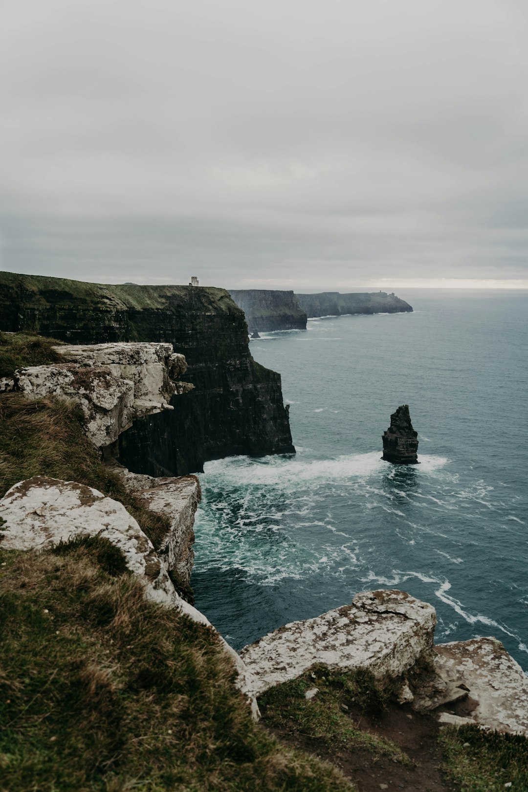
What Is Dún Aonghasa?
Dún Aonghasa (pronounced “doon-AYN-ghus-ah”) is a prehistoric stone fortress on the western edge of Inis Mór. Archaeologists date its construction to around 1100 BC, putting it firmly in the Bronze Age. It covers roughly 14 hectares and sits at the top of a limestone cliff that falls 100 metres to the sea below.
The fort takes a D-shape — four concentric rings of dry stone walls forming a semicircle. The open end faces west, directly over the cliff edge. From inside the innermost wall, you stand about one metre from a 100-metre drop with nothing between you and the Atlantic.
This layout has puzzled archaeologists for more than 150 years. No written records exist from the time of construction — the Aran Islands predate any Irish textual history. Everything researchers know about Dún Aonghasa comes from excavation, stone analysis, and educated inference. Much remains in dispute.
The Chevaux-de-Frise: Thousands of Sharp Stones
Between the outermost and middle walls, the builders planted thousands of sharp limestone slabs upright in the ground. These point outward at irregular angles, covering an area roughly 40 metres wide. This feature has a French military name — chevaux-de-frise — meaning “Frisian horses,” after a similar defensive technique used by Frisian infantry in 17th-century Europe against cavalry.
The presence of this feature at Dún Aonghasa is significant for two reasons. First, it confirms the site served some defensive purpose — you do not plant thousands of stone spikes unless you expect someone to try walking through them. Second, archaeologists found the same technique at several other prehistoric sites in Ireland and continental Europe, suggesting some communication or shared knowledge between distant cultures at this period.
Walking through the chevaux-de-frise on the marked path today, it is easy to see how effective the field would have been. The stones vary from knee-height to waist-height, closely spaced and completely irregular. Moving quickly through them would be nearly impossible.
☘️ Enjoying this? 64,000+ Ireland lovers get stories like this every week. Subscribe free →
The Mystery of the Open Cliff
So if Dún Aonghasa served as a fort, why does its strongest wall face inward, not outward? And why does it have no back wall at all?
Three main theories exist among archaeologists:
- Erosion theory: When the builders constructed Dún Aonghasa 3,000 years ago, the cliff edge was much further west. The fort originally had a complete back wall and a fully enclosed courtyard. Over the following millennia, the Atlantic gradually eroded the limestone beneath, and the back section of the fort simply fell into the sea. Under this theory, Dún Aonghasa is an incomplete survivor of a once-circular structure.
- Deliberate design theory: Some archaeologists argue the open cliff face was intentional. A 100-metre vertical drop needs no wall — nothing can climb it. The builders were efficient. They used the natural geography as their rear defence, concentrating their labour on the landward walls where an attack could actually come.
- Ceremonial purpose theory: A third group of researchers suggests Dún Aonghasa was never purely a military installation. The effort required to build four concentric stone rings containing roughly 14 hectares — on a small island, using only hand tools — may reflect religious or ceremonial significance. The cliff edge could have served as a ritual boundary: a place where the world ended and something else began.
Most archaeologists today accept that Dún Aonghasa probably served multiple purposes across its long history, and that none of these theories fully explains the site. The erosion evidence is real — the limestone cliffs here do erode, at a rate of approximately 0.4 metres per year — but whether a complete back wall ever existed remains unproven.
What the Excavations Found
In 1992, archaeologist Claire Cotter led a major excavation of Dún Aonghasa, producing the most detailed evidence yet of how the site developed. The dig found that the innermost wall was the oldest, dating to around 1100 BC. The builders added the outer walls later, in stages, over the following centuries. The site grew outward rather than inward.
The excavations also recovered animal bones, charcoal deposits, and fragments of Bronze Age pottery and metal-working debris. This confirms people lived at or regularly used the site — it was not just a look-out post. The presence of metal-working evidence is particularly interesting, as iron and bronze were valuable commodities and the skills to work them conferred significant status.
Interestingly, archaeologists found no evidence of human remains at the site. If Dún Aonghasa served as a ritual centre or was associated with burial practices, the evidence has not survived or is buried below the excavated layers.
Who Built It and Who Was Aonghus?
The fort takes its name from Aonghus, a figure in Irish mythology. Aonghus mac Umóir was supposedly a leader of the Fir Bolg — a mythological race of people who, according to medieval Irish texts, inhabited Ireland before the Tuatha Dé Danann (the divine beings of Irish mythology) arrived and defeated them at the First Battle of Mag Tuired. The surviving Fir Bolg supposedly retreated to the Aran Islands.
Historians treat the Fir Bolg as a mythologised memory of real prehistoric inhabitants, not as a literal historical account. The name “Dún Aonghasa” — the fort of Aonghus — connects the site to this older layer of Irish identity: a reminder that the islands were already ancient and significant long before any history was written down.
In Irish mythology, Aonghus Óg (a different, more famous Aonghus) is the god of love and poetry, associated with the River Boyne and Newgrange. The connection between the Aran Islands Aonghus and the mythological figure is unclear and probably coincidental.
How to Visit Dún Aonghasa
Dún Aonghasa is one of the most visited heritage sites in Ireland, managed by the Office of Public Works (OPW). Here is the practical information for planning a visit:
- Getting to Inis Mór: Take the Aran Island Ferries from Rossaveal, County Galway (45-minute crossing, approximately €25 return). Doolin Ferry in County Clare also runs services (about 90 minutes). From Galway city to Rossaveal by bus takes about 40 minutes.
- Getting to the fort: The OPW visitor centre sits about 2 kilometres below the fort. From there, a clearly marked path climbs 100 metres over limestone pavement. The walk takes 20 to 30 minutes each way.
- Entry fees: The visitor centre charges approximately €5 per adult and €3 per child (2026 prices). This includes access to the path and the fort itself.
- What to bring: Comfortable walking shoes with grip — the limestone path can be slippery when wet. The exposed hilltop is also significantly windier than the village below, so bring a layer even in summer.
- Time needed: Allow at least 2 hours on Inis Mór for the fort alone. A full day on the island — by bicycle or pony-and-trap — covers the village of Kilronan, the coastal scenery, and the smaller forts of Dún Duchathair and Dún Eochla as well.
- Photography: Stay well back from the cliff edge. The limestone surface at the cliff edge can be unstable, and there are no barriers between you and a 100-metre drop.
The View From the Top
From inside the innermost wall of Dún Aonghasa, on a clear day, you can see the Cliffs of Moher to the southeast and the mountains of Connemara to the north. Directly west, there is nothing between you and America.
It is one of the most dramatic viewpoints in Ireland, and one of the most honest. The Bronze Age builders who chose this site understood exactly what they were doing. Whether they built here for defence, for ceremony, or simply because this flat limestone plateau above the world’s edge was the most powerful place they knew — standing at the cliff today, it is hard to argue with the decision.
October is Family History Month — for the millions of people with Connacht ancestry, the Aran Islands were part of the world their families left. Our free Irish Ancestry Guide at the link below can help trace exactly which Galway parish and townland they came from before they went.
What is Dún Aonghasa?
Dún Aonghasa is a prehistoric stone fortress on the western cliff edge of Inis Mór, the largest of the Aran Islands in County Galway, Ireland. It dates to around 1100 BC and covers roughly 14 hectares across four concentric semicircular stone walls.
Why does Dún Aonghasa have no back wall?
The most widely held theories are that the cliff itself served as the rear defence (making a wall unnecessary), or that the back section of the fort eroded away as the Atlantic gradually wore down the limestone cliffs over 3,000 years. Archaeologists have not settled the question definitively.
How old is Dún Aonghasa?
Archaeologists date the innermost wall of Dún Aonghasa to around 1100 BC, placing it in the late Bronze Age. The outer walls came later, added in stages over subsequent centuries. The site is roughly 3,000 years old.
How do you get to Dún Aonghasa?
Take a ferry from Rossaveal in County Galway (45-minute crossing) or from Doolin in County Clare (90-minute crossing) to Inis Mór. From the island’s main village of Kilronan, the OPW visitor centre is a short cycle or taxi ride away. The fort itself is a 2km walk uphill from the visitor centre.
Is Dún Aonghasa worth visiting?
Yes. Dún Aonghasa is one of the most dramatically positioned prehistoric monuments in Europe, sitting 100 metres above the Atlantic with unobstructed views west. The combination of archaeological significance and natural setting makes it one of Ireland’s most memorable heritage sites.
☘️ Join 64,000+ Ireland Lovers
Every weekday morning, get Ireland’s hidden gems, local secrets, and travel inspiration — the kind you won’t find in any guidebook.
Subscribe free — enter your email:
Already subscribed? Download your free Ireland guide (PDF)
📲 Know someone who’d love this? Share on WhatsApp →
Love more? Join 43,000 Scotland lovers → · Join 29,000 Italy lovers → · Join 7,000 France lovers →
Free forever · Unsubscribe anytime
Tours & experiences you might love


Powered by Viator. Some links are affiliate links — we may earn a small commission at no extra cost to you.
Secure Your Dream Irish Experience Before It’s Gone!
Planning a trip to Ireland? Don’t let sold-out tours or packed attractions spoil your journey. Iconic experiences like visiting the Cliffs of Moher, exploring the Rock of Cashel, or enjoying a guided walk through Ireland’s ancient past often sell out quickly—especially during peak travel seasons.

Booking in advance guarantees your place and ensures you can fully immerse yourself in the rich culture and breathtaking scenery without stress or disappointment. You’ll also free up time to explore Ireland’s hidden gems and savour those authentic moments that make your trip truly special.
Make the most of your journey—start planning today and secure those must-do experiences before they’re gone!