

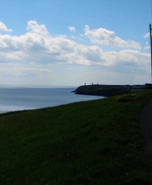
Tramore is a seaside town in County Waterford with a population of 11,277 at the 2022 Census, a 5 km beach and a Blue Flag for the 2026 season. It suits retirees and families who want a big beach and a bus to Waterford city, with the nearest emergency department about 15 km away. Source: CSO: Census 2022, table F1046 (population of towns); Discover Ireland: Tramore Beach; Waterford City & County Council: An Taisce announces Blue Flag and Green Coast awards for 2026.
Last checked: 20 November 2026. Every line below links to the page it came from. We give no prices (apart from one rent figure from the Residential Tenancies Board), fees or waiting times; check the official pages before you act.
Who Tramore suits
Retirees: A resort town of about 11,300 people with a 5 km beach, and Bus Éireann route 360 to Waterford city. Source: CSO: Census 2022, table F1046 (population of towns); Discover Ireland: Tramore Beach; Bus Éireann: route 360, Waterford to Tramore.
Families: The beach and the sea are the main draw: Discover Ireland describes 5 km of sandy beach with dunes and cliff walks, and the 2026 Blue Flag covers the bathing season. Source: Discover Ireland: Tramore Beach; Waterford City & County Council: An Taisce announces Blue Flag and Green Coast awards for 2026.
A story from Tramore
Above Tramore Bay stands the Metal Man, a cast-iron sailor on a pillar near Newtown Cove, who points to Hook Head and the entrance to Waterford Harbour. Source: Waterford City & County Council: The Metal Man; Tramore.ie: The Metal Man.
The beacons on the headland were built after the loss of HMS Sea Horse in 1816, when the ship grounded at Brownstown Head in bad weather; the Metal Man is dressed as a British sailor of that time. Source: Tramore.ie: The Metal Man; Waterford City & County Council: The Metal Man.
Waterford City and County Council notes that early twentieth-century photographs show a long-lost tradition in which a chain of unmarried women would hop around the base of the tower three times. Source: Waterford City & County Council: The Metal Man.
Hospital and airport
The nearest hospital with an HSE emergency department is University Hospital Waterford on the Dunmore Road, about 15 km by road (approximate). Source: HSE: University Hospital Waterford Emergency Department (Find urgent and emergency care); OpenStreetMap routing (OSRM): road distances, rounded to the nearest 5 km; OpenStreetMap (Nominatim): place coordinates.
Cork Airport is about 130 km by road (approximate). RTÉ reported in May 2026 that there has been no regular passenger service at Waterford Airport since 2016, so it is not counted here. Source: Cork Airport; RTÉ: Waterford Airport (18 May 2026); OpenStreetMap routing (OSRM): road distances, rounded to the nearest 5 km; OpenStreetMap (Nominatim): place coordinates.
Getting around
Bus Éireann route 360 runs between Waterford and Tramore. Source: Bus Éireann: route 360, Waterford to Tramore.
Irish Rail’s station list has no station in Tramore; Waterford (Plunkett) is the Irish Rail station for Waterford. Source: Iarnród Éireann: Find a station (full station list); Iarnród Éireann: Waterford (Plunkett) station.
The setting and the weather
A seaside resort town on Tramore Bay on the County Waterford coast, with a promenade (the Prom) and a 5 km beach with sand dunes. Source: Discover Ireland: Tramore Beach; Waterford City & County Council: Tramore.
Met Éireann’s 1991-2020 1 km rainfall grid gives about 1,000 to 1,040 mm a year for the cells around Tramore (1,003 to 1,035 mm in the four nearest the town centre), well below the national average of about 1,288 mm. These are long-term averages, not a forecast. Source: Met Éireann: 30 year averages (1 km rainfall grid 1991-2020, Climatological Note No. 22); Met Éireann: Ireland’s Climate Averages 1991-2020 (national average rainfall).
Check live weather and the 7-day forecast for County Waterford.
What rent looks like
RTB Rent Index, Q1 2026, standardised average for new tenancies in County Waterford: €1,371 a month. This is a county average, not a figure for Tramore alone. Source: RTB Rent Index, Q1 2026 (RTB/ESRI), new tenancies, standardised average rent by county; RTB: Tables for new tenancies, Q1 2026 (Table 16, county averages).
Your family’s county
If your family came from County Waterford, our County Waterford family records page shows what is online, from when, and where.
Things to do nearby
- Tramore Beach: Discover Ireland’s listing describes about 5 km of sandy beach with dunes and cliff walks and notes a Blue Flag. Source: Discover Ireland: Tramore Beach.
- The Metal Man (Waterford City & County Council): The council’s page on the cast-iron figure, its pillar and the 1816 wreck behind it. Source: Waterford City & County Council: The Metal Man.
- Tramore (Waterford City & County Council): The council’s page on the town, including the water sports facility being built on the Prom. Source: Waterford City & County Council: Tramore.
Tours near Tramore
- Lafcadio Hearn Japanese Gardens Admission Adult Ticket (in Tramore)
- House of Waterford Crystal Guided Factory Tour (in Waterford city, County Waterford)
- Waterford Treasures: Medieval Museum Admission Ticket (in Waterford city, County Waterford)
Tours are booked through Viator, and we may earn a commission at no extra cost to you. See all our tours.
More from us on Tramore
Common questions
How big is Tramore? The CSO’s Census 2022 gives Tramore a population of 11,277. Source: CSO: Census 2022, table F1046 (population of towns).
Is there a train to Tramore? Irish Rail’s station list has no station in Tramore. Waterford (Plunkett) is the nearest Irish Rail station and Bus Éireann route 360 links Tramore with Waterford. Source: Iarnród Éireann: Find a station (full station list); Iarnród Éireann: Waterford (Plunkett) station; Bus Éireann: route 360, Waterford to Tramore.
How far is the nearest hospital emergency department? University Hospital Waterford is about 15 km by road, an approximate figure from OpenStreetMap routing. Source: HSE: University Hospital Waterford Emergency Department (Find urgent and emergency care); OpenStreetMap routing (OSRM): road distances, rounded to the nearest 5 km.
This page is part of Live in Ireland. See also our housing, healthcare and first 90 days pages.
Sources
- OpenStreetMap routing (OSRM): road distances, rounded to the nearest 5 km
- OpenStreetMap (Nominatim): place coordinates
- RTB Rent Index, Q1 2026 (RTB/ESRI), new tenancies, standardised average rent by county
- RTB: Tables for new tenancies, Q1 2026 (Table 16, county averages)
- CSO: Census 2022, table F1046 (population of towns)
- Cork Airport
- Iarnród Éireann: Find a station (full station list)
- HSE: University Hospital Waterford Emergency Department (Find urgent and emergency care)
- RTÉ: Waterford Airport (18 May 2026)
- Bus Éireann: route 360, Waterford to Tramore
- Iarnród Éireann: Waterford (Plunkett) station
- Discover Ireland: Tramore Beach
- Waterford City & County Council: An Taisce announces Blue Flag and Green Coast awards for 2026
- Waterford City & County Council: The Metal Man
- Tramore.ie: The Metal Man
- Waterford City & County Council: Tramore
- Met Éireann: 30 year averages (1 km rainfall grid 1991-2020, Climatological Note No. 22)
- Met Éireann: Ireland’s Climate Averages 1991-2020 (national average rainfall)