

Coumeenoole Beach sits at the far western tip of the Dingle Peninsula in County Kerry, facing directly into the Atlantic Ocean. There are no cafés here, no car parks with tarmac, no lifeguards on duty. What you get instead is one of the most dramatic stretches of coastline in Ireland — steep cliffs, crashing surf, golden sand, and a silence that feels earned. It regularly features among the best beaches on the Wild Atlantic Way.
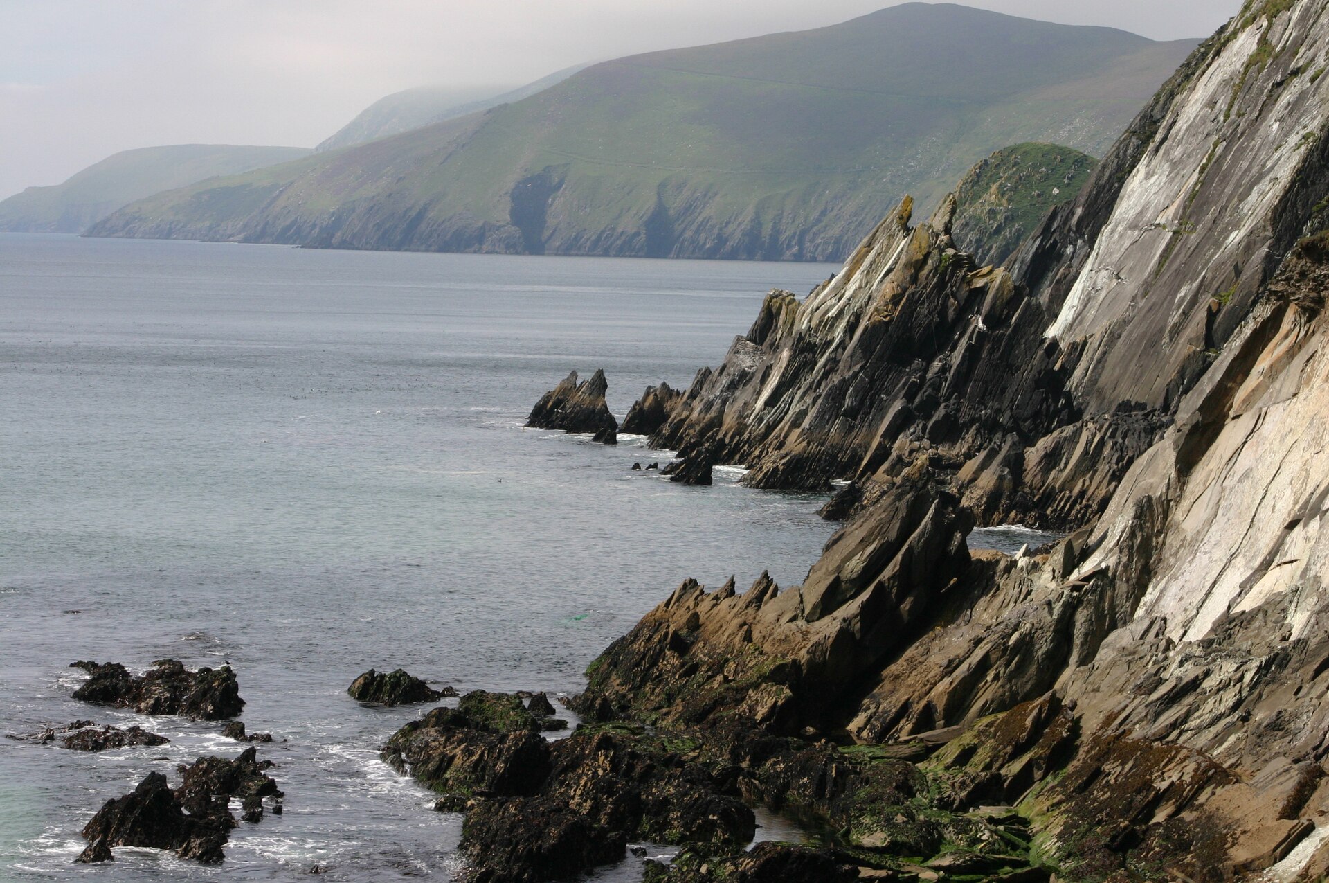
It is not the kind of beach you visit for a lazy summer afternoon. It is the kind you visit when you want to understand what Ireland’s wild west coast actually looks like before tourism arrived.
Where Is Coumeenoole Beach?
Coumeenoole (sometimes spelled Coumeenole or Couminoole) sits near Dunmore Head, the most westerly point of mainland Ireland, in the parish of Dún Chaoin (Dunquin) in County Kerry. It lies at the end of Slea Head Drive, the scenic loop road that circles the tip of the Dingle Peninsula.
The nearest town is Dingle, roughly 15 kilometres to the east. The Blasket Islands sit just off the coast — on a clear day you can see Great Blasket, Beginish, and the Sleeping Giant formation clearly from the beach. These islands were famously inhabited until 1953, when the last residents were evacuated to the mainland, and their remoteness gives the whole area a sense of being at the edge of the known world.
Coumeenoole featured in the 1970 film Ryan’s Daughter, directed by David Lean — particularly in the famous storm scene. Visitors still come looking for that stretch of beach, and it delivers.
What to Expect When You Arrive
The approach to Coumeenoole is part of the experience. Slea Head Drive winds along cliff tops with the ocean far below, passing stone walls, ancient beehive huts (clocháns), and views that stop most people in their tracks. The road is narrow — genuinely single-track in places — so take it slowly.
Parking is informal and limited: a small rough area near the cliff path, with space for perhaps a dozen vehicles. In summer it fills early, so aim to arrive before 10am or after 4pm. There are no facilities at the beach itself — no toilets, no food vans, no information boards.
The path down to the sand is steep and uneven, and can be slippery when wet. Wear shoes with grip. The beach itself is small and sheltered in a cove between high headlands, which is part of what makes it so striking. The cliffs on either side rise dramatically, and the sand is pale gold against the dark rock.
Swimming is possible, but the Atlantic swells here are powerful and the currents unpredictable. This is not a supervised beach. Adults with strong swimming ability do swim here on calmer days, but you should check conditions carefully and never swim alone.
Get more Ireland travel guides in your inbox
We send weekly articles on Ireland’s best beaches, walks, towns, and hidden corners — straight to your inbox, free.
The Dingle Peninsula: Context and Scale
Coumeenoole makes more sense when you understand what surrounds it. The Dingle Peninsula (An Daingean Uíbh Ráthach) stretches roughly 48 kilometres into the Atlantic from Tralee Bay, with the Slieve Mish Mountains running along its spine. It is one of the most concentrated areas of archaeological sites in Ireland, with thousands of recorded monuments packed into a relatively compact area.
This is also a Gaeltacht area — Irish is spoken as a first language by many residents in Dún Chaoin and the surrounding parishes. Road signs are in Irish only in parts of the peninsula (Corca Dhuibhne), which can catch visitors off guard. The culture here is distinct and genuinely living, not performed for tourism.
The Great Blasket Island was home to a remarkable literary tradition in the early 20th century, producing writers like Tomás Ó Criomhthain (An tOileánach / The Islandman) and Peig Sayers (Peig). The Blasket Centre in Dún Chaoin covers this history in detail — it is one of the better visitor centres in Kerry and worth an hour of your time.
Ferries to Great Blasket run from Dún Chaoin pier (roughly 2 kilometres from Coumeenoole) in summer. The island has a café and basic facilities, and you can walk most of it in a half day. Day trips run weather-dependent, so book in advance and keep your dates flexible.
Walks and Headlands Near Coumeenoole
Coumeenoole is a starting point for coastal walking, not just a beach visit. The cliff paths around Dunmore Head are rough in places but offer extraordinary views of the Blaskets and back along the coast towards Slea Head. The Dingle Way long-distance walk passes through this area — the full route covers roughly 179 kilometres, but day sections are clearly marked.
Slea Head itself is about a kilometre north of Coumeenoole along the road. A small car park and viewpoint marker sits at the headland, and on a clear day the panorama takes in the Blaskets, the Skellig Islands (on very clear days), and the sweep of the bay towards Dingle. The Skellig Islands — home to one of the world’s most dramatic early Christian monasteries — are visible roughly 60 kilometres to the south on days with good visibility.
For a more structured walk, the loop from Coumeenoole to Slea Head and back via the cliff path takes about 90 minutes at an easy pace. The path is not formally waymarked in all sections, so a basic map or downloaded GPS track helps. The terrain is rough grassland and cliff edge — keep children and dogs under close control near the edges.
Wildlife Along This Stretch of Coast
The waters around the Dingle Peninsula are among the best in Ireland for marine wildlife. Common bottlenose dolphins have a resident population in Dingle Bay — the town of Dingle has been associated with Fungie the dolphin since 1983, though the area’s dolphin population extends well beyond any individual animal. Boat trips from Dingle harbour run year-round for dolphin watching.
From Coumeenoole and the nearby cliffs, grey seals can often be spotted in the water below, particularly around the rocky outcrops. Choughs (distinctive red-billed and red-legged crows) are seen regularly along these cliffs — the Dingle Peninsula has one of Ireland’s stronger chough populations. Peregrine falcons nest in the cliff faces in season.
In late summer and autumn, basking sharks sometimes appear in the bay. These are the world’s second-largest fish and entirely harmless to swimmers, feeding only on plankton. Sightings are occasional rather than guaranteed, but this stretch of coast is one of the more reliable spots in Kerry.
Planning a trip to Kerry or the Dingle Peninsula?
Our free newsletter covers Ireland’s coastal towns, beaches, walking routes, and seasonal travel tips every week.
Best Time to Visit Coumeenoole
Coumeenoole is worth visiting in any season, but each has different conditions.
Summer (June–August) brings the most reliable weather and the longest daylight — sunset at Slea Head in late June is after 10pm. The beach gets busiest in July and August, though “busy” here means a few dozen people rather than crowds. Temperatures on the exposed peninsula rarely exceed 18–20°C even in peak summer.
Spring and autumn offer quieter conditions, dramatic light, and storms that are spectacular to watch from a safe distance on the cliff tops. April and May bring wildflowers along the cliff paths, including sea pinks (thrift) in large drifts. October storms on this coast are genuinely powerful — waves reaching 15 metres or more on the worst days.
Winter is quiet, cold, and extraordinarily atmospheric. The short days and frequently overcast skies give the whole area a different quality — not hostile, exactly, but serious. The Blaskets look like shapes from a different era. Many businesses in Dún Chaoin and the surrounding area reduce hours or close entirely from November to March, so check before travelling.
Rain is possible in any month. The western tip of the Dingle Peninsula averages around 1,400mm of rainfall annually — bring waterproofs regardless of the forecast.
Getting to Coumeenoole Beach
Coumeenoole is best reached by car. From Dingle town, follow the R559 west along Slea Head Drive — it loops around the tip of the peninsula and returns to Dingle via Ventry. The drive is roughly 45 minutes including stops, but most people take longer.
The road is narrow and winding. Campervans and large vehicles are strongly discouraged, and several sections have height and width restrictions. In summer 2023, Kerry County Council introduced a traffic management system on parts of Slea Head Drive to reduce congestion — check the current situation before travelling as restrictions may be updated seasonally.
There is no regular public bus service to Coumeenoole. The Dingle area has limited public transport generally — a bus connects Dingle to Tralee and onwards to Killarney, but the peninsula loop roads are not covered. Cycling Slea Head Drive is popular and the road is well-suited to it, though the climbs are significant.
From Dublin, the drive to Dingle via the N7 and N21 takes approximately four hours. From Cork city it is roughly two and a half hours. Killarney is about 90 minutes away and often used as a base for day trips to the Dingle Peninsula.
What to Bring and Practical Notes
Given the lack of facilities at Coumeenoole itself, bring everything you need before you arrive:
- Water and food — there is nothing at the beach and limited options on the Slea Head loop
- Waterproof jacket and an extra layer — wind chill on exposed headlands is significant
- Footwear with grip for the cliff paths and beach access
- A physical map or downloaded offline route if you plan to walk beyond the beach
- A bin bag — there are no bins at Coumeenoole, and pack-in/pack-out is the norm
Mobile signal is variable along the Slea Head loop. Some providers have coverage, others drop out entirely on the western tip. Do not rely on live navigation apps on this section — download the map beforehand.
Coumeenoole sits within an area of outstanding natural beauty with significant archaeological value. The surrounding farmland is actively worked — close gates behind you, keep dogs on leads around livestock, and stay on established paths near the cliff edges. The ground can be unstable near cliff tops after heavy rain.
It is one of those places that stays with you long after you have left — not because it is dramatic for drama’s sake, but because it is honest. This is what the Atlantic coast looked like before modern Ireland, and in many ways it still does.
Explore more of Ireland’s coastline
From Kerry’s beaches to Donegal’s cliffs and everything in between — our free newsletter brings you Ireland’s best travel writing every week.
Thinking about it seriously?
If you’ve started actually planning a move, our complete the full Move to Ireland guide walks through every step, every cost, and the paperwork that catches most people out.
Tours & experiences you might love


Powered by Viator. Some links are affiliate links — we may earn a small commission at no extra cost to you.
Secure Your Dream Irish Experience Before It’s Gone!
Planning a trip to Ireland? Don’t let sold-out tours or packed attractions spoil your journey. Iconic experiences like visiting the Cliffs of Moher, exploring the Rock of Cashel, or enjoying a guided walk through Ireland’s ancient past often sell out quickly—especially during peak travel seasons.

Booking in advance guarantees your place and ensures you can fully immerse yourself in the rich culture and breathtaking scenery without stress or disappointment. You’ll also free up time to explore Ireland’s hidden gems and savour those authentic moments that make your trip truly special.
Make the most of your journey—start planning today and secure those must-do experiences before they’re gone!
Subscribe Free