

The question seems simple enough: if you drew a straight line across Ireland from one coast to the other, what would it pass through? The answer tells you more about the shape of this island than almost any guidebook would. Ireland is compact — roughly 486 kilometres long and 275 kilometres wide at its broadest — but it packs in a remarkable variety of terrain. Mountains, bogs, river systems, market towns, and flat farmland all sit within a short distance of one another. Tracing a line across the map is a useful way to understand what’s actually here.
We’ve picked three lines and followed them from coast to coast. Each one passes through a different cross-section of the island and reveals something different about Ireland’s geography, history, and character.
Want more stories like this? Our free newsletter covers Ireland’s landscapes, history, and hidden places every week. Subscribe to the Love Ireland newsletter here.
The Classic East-West Line: Dublin Bay to Galway Bay
The most obvious line runs east to west, from Dublin Bay on the Irish Sea to Galway Bay on the Atlantic. The straight-line distance is approximately 220 kilometres.
Starting on the Irish Sea coast, the line enters Dublin — a city of 1.4 million people and the country’s only true metropolis. Cross the River Liffey, pass through the Georgian streets of the city centre, and the line immediately begins to climb. To the south and west of the city, the Dublin Mountains rise sharply from the suburbs. These are the northern end of the Wicklow Mountains, the largest continuous upland area in Ireland. The highest peak in the range, Lugnaquilla, reaches 925 metres.
Beyond the mountains, the land drops away onto the Central Lowlands — the broad, flat plain that forms the heart of Ireland. County Kildare comes first, famous for its horse-racing studs and the Curragh, a 5,000-acre expanse of open grassland where racehorses have been trained for hundreds of years. The land here is some of the most productive in the country.
Heading further west, the line enters peat bog country. The Bog of Allen is the largest raised bog complex in Ireland, covering parts of seven midland counties including Kildare, Offaly, and Laois. These bogs have been cut for fuel for centuries — first by hand, then industrially from the 1940s onwards. Large sections have been drained and harvested, though conservation efforts have protected what remains.
Then comes the River Shannon. At 360 kilometres, it is the longest river in Ireland and in Britain. The Shannon runs almost due north to south through the middle of the country, and any east-west line will have to cross it. Near Athlone or Portumna, the river widens into lakes before narrowing again. The Shannon has always been a natural barrier — it formed the western boundary of the English Pale in the medieval period, and crossing it once meant entering a different world.
On the western bank, County Galway opens up. The landscape shifts as you move into Connaught — the western province. Rocky fields divided by dry-stone walls replace the smooth farmland of the midlands. The soil is thin and the ground is often waterlogged. In the distance, the Twelve Bens rise above Connemara, a range of quartzite peaks. The line ends at Galway Bay, where the Atlantic faces out toward North America and the Aran Islands sit three kilometres offshore.
The Long Line North to South: Malin Head to Mizen Head
Ireland’s geography is inseparable from its history — and if your family roots lie somewhere along that line, our guide to Irish Townlands: Discover Where Your Ancestors Really Came From can help you pinpoint the exact townland they called home.
The most famous route in Ireland runs from Malin Head in County Donegal — the northernmost point on the island — to Mizen Head in County Cork, the southwest tip. The straight-line distance is roughly 486 kilometres.
Malin Head sits on the Inishowen Peninsula, a headland of granite cliffs above the Atlantic. The area around it is windswept and remote. The nearest town of any size is Carndonagh, about 15 kilometres inland. This is one of the most sparsely populated parts of Ireland — County Donegal has around 167,000 people spread across 4,860 square kilometres.
Heading south, the line crosses the Blue Stack Mountains in central Donegal before entering County Sligo. This is the landscape associated with the poet W.B. Yeats — Benbulben, the distinctive flat-topped mountain, rises above the county town, and the Atlantic coast is full of surfing beaches. County Leitrim, which follows, is Ireland’s least populous county, with around 35,000 residents.
Further south, the line passes through Roscommon and into Tipperary — the Golden Vale. This is the most fertile agricultural land in Ireland. The ground here is deep limestone, and the grass grows almost year-round. It supports the country’s largest concentration of dairy cattle. County Tipperary alone produces around ten per cent of Ireland’s milk.
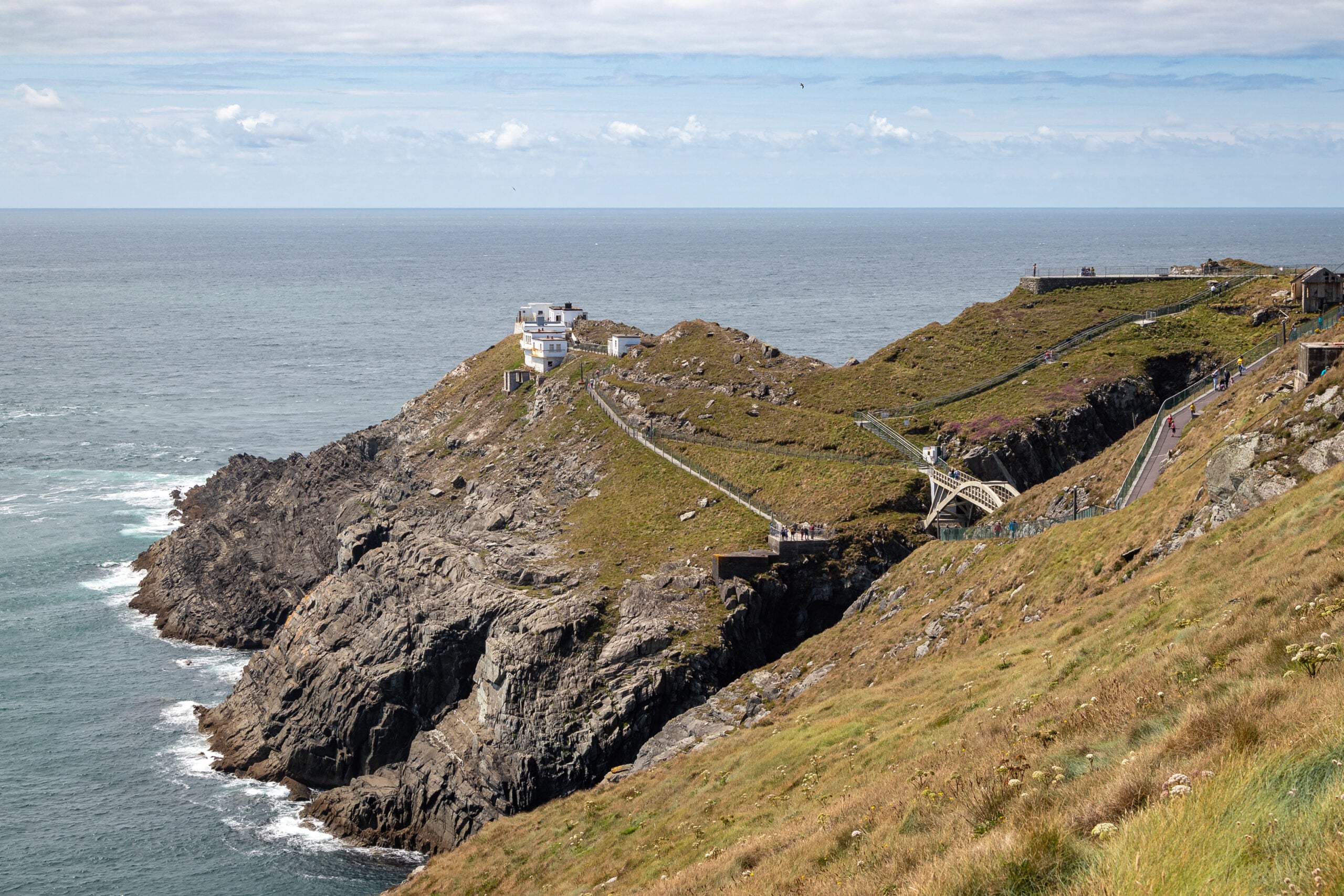
Down in County Cork, the terrain changes again. The Lee Valley runs east to west, with Cork city sitting at its tidal mouth. West Cork is a patchwork of small farms, fishing villages, and narrow roads. The Mizen Peninsula is the last finger of land before the Atlantic takes over entirely. Mizen Head itself is a 45-metre cliff, and the lighthouse sits on a small island connected to the mainland by a footbridge. In winter, Atlantic swells regularly crash over the rocks below.
Exploring Ireland from the inside out? Our newsletter goes beyond the tourist trail. Subscribe free and get Ireland in your inbox each week.
What Actually Sits in the Middle of Ireland?
The geographic centre of Ireland is a matter of mild dispute. The most commonly cited location is near the village of Carnagh in County Roscommon, though some calculations place it in County Westmeath. The difference comes down to how you measure the coastline and whether you include offshore islands.
Athlone is usually described as the closest town of any size to the true centre of the island. It sits on the River Shannon in County Westmeath, roughly equidistant from the east and west coasts. It’s a market town of around 24,000 people with a Norman castle on the riverbank. For most of its history, Athlone’s importance came entirely from the river crossing it controlled.
The Hill of Uisneach, also in Westmeath, has a more symbolic claim to the centre. In early Irish mythology, Uisneach was considered the sacred midpoint of the island, where the five ancient provinces met. A large limestone boulder called the Cat Stone still stands on the hill, and the views from the top stretch to several counties on a clear day.
The Mountains That Break Every Straight Line
No straight line across Ireland runs truly flat. The island has three main upland areas that will interrupt any cross-country route.
In the east, the Wicklow Mountains are the most accessible from Dublin and the most heavily walked. The Wicklow Way, Ireland’s oldest waymarked trail, runs for 127 kilometres through them. The Military Road that crosses the range was built after the 1798 rebellion so that British troops could reach remote glens — before that, much of the interior was effectively inaccessible.
In the west, the mountains are rougher and less visited. County Mayo’s Nephin Beg range is one of the most remote mountain areas in Ireland. There are no roads through it, and it was once the site of one of Ireland’s great blanket bog systems. County Kerry has Carrauntoohil, the highest mountain in Ireland at 1,038 metres, which sits in the MacGillycuddy’s Reeks range near Killarney.
In the north, the Sperrin Mountains run through Counties Tyrone and Londonderry. They’re less dramatic than the western ranges but cover a wide area. Gold has been found in the Sperrins, and there is ongoing debate about the scale of potential mining. The mountains form a long, rounded ridge across mid-Ulster and would bisect any north-south line through the province.
Ireland’s Rivers Cross Every Route
Ireland has more rivers per square kilometre than most European countries, and any straight line across the island will cross at least three or four of them.
The Shannon is the unavoidable one. But the Barrow (193 km), the Suir (184 km), and the Nore (140 km) together form what’s known as the Three Sisters — three rivers that rise separately in the midlands and merge near New Ross before flowing into Waterford Harbour in the southeast. They were the main arteries of inland trade for centuries, and the towns along their banks — Kilkenny, Carlow, Clonmel, Waterford — were among the wealthiest in medieval Ireland.
In the north, the Erne system dominates. Lough Erne in County Fermanagh is split into two lakes — Upper and Lower — connected by the river. The lakeshore is dotted with early Christian sites, including monastery islands that were established by monks in the sixth and seventh centuries.
Ireland’s rivers shaped where people settled. Dublin, Limerick, Cork, Galway, and Drogheda all began as crossing points or harbour settlements on rivers. Following the rivers is one of the clearest ways to understand the country’s settlement history.
How to Turn This Into a Real Road Trip
If this thought experiment makes you want to actually cross Ireland coast to coast, the practical options are straightforward. The Dublin to Galway drive along the M6 motorway takes about two and a half hours and follows a route very close to the east-west straight line. It’s fast and flat, and it passes through exactly the kind of midland landscape described above — bog, farmland, river crossings, and market towns.
A slower alternative is the Royal Canal Greenway, a 130-kilometre cycling and walking route that follows the old Royal Canal from Dublin west into County Westmeath. The canal itself dates from the 1790s and was built to compete with the Grand Canal to the south. The greenway is flat, well surfaced, and accessible to most cyclists. It passes through some of the quietest midland countryside in Ireland and gives you a ground-level view of the interior that no car journey does.
For the north-south route, a direct inland drive from Donegal to Cork along the N17 and N18 — through Sligo, Galway, and Limerick — takes around five and a half hours without stops. The road passes through the Shannon basin, the Golden Vale, and the Lee Valley, and the landscape changes noticeably at each stage.
Planning a trip across Ireland? Our newsletter covers the routes, towns, and landscapes worth knowing about. Subscribe free — no spam, just Ireland.
Ireland is a small island — about the size of the state of Indiana, and a little smaller than the island of Newfoundland. A straight line from coast to coast is never more than 275 kilometres wide. But within that distance, you’ll cross mountain ranges, ancient bogs, the longest river in the British Isles, and farmland that has been worked continuously for thousands of years. The next time you look at a map of Ireland, draw that line. What sits between the coasts is as much Ireland as the coasts themselves.
☘️ Join 64,000+ Ireland Lovers
Every weekday morning, get Ireland’s hidden gems, local secrets, and travel inspiration — the kind you won’t find in any guidebook.
Subscribe free — enter your email:
📲 Know someone who’d love this? Share on WhatsApp →
Love more? Join 43,000 Scotland lovers → · Join 29,000 Italy lovers → · Join 7,000 France lovers →
Free forever · Unsubscribe anytime
Tours & experiences you might love


Powered by Viator. Some links are affiliate links — we may earn a small commission at no extra cost to you.
Secure Your Dream Irish Experience Before It’s Gone!
Planning a trip to Ireland? Don’t let sold-out tours or packed attractions spoil your journey. Iconic experiences like visiting the Cliffs of Moher, exploring the Rock of Cashel, or enjoying a guided walk through Ireland’s ancient past often sell out quickly—especially during peak travel seasons.

Booking in advance guarantees your place and ensures you can fully immerse yourself in the rich culture and breathtaking scenery without stress or disappointment. You’ll also free up time to explore Ireland’s hidden gems and savour those authentic moments that make your trip truly special.
Make the most of your journey—start planning today and secure those must-do experiences before they’re gone!