

There are places in Ireland that make you stop and take a long breath. Dunquin Pier — or Dún Chaoin Pier, as it is known in Irish — is one of them. Located at the far western tip of the Dingle Peninsula in County Kerry, it sits at one of the most westerly points in all of Europe. On a clear day, you can look out across the Atlantic and see nothing but water until the next landmass — North America, roughly 3,000 miles away.
This is not a pier you stumble upon. You have to go looking for it. And when you find it, you will understand why it is worth the journey.
There is a particular kind of silence here that is hard to find elsewhere. Wind, yes — often quite a lot of it — but beneath that, a quiet that comes from being genuinely far from everything. No motorway sounds, no city hum. Just the Atlantic, the cliffs, and the slow movement of the tide.
If you love discovering Ireland’s hidden corners, our free weekly newsletter is packed with guides, local tips, and inspiration. Subscribe here and join thousands of Ireland lovers every week.
What Is Dunquin Pier?
Dunquin Pier is a small working harbour at the base of dramatic sea cliffs on the Slea Head Drive loop. The pier here has served the Blasket Islands community since the nineteenth century, providing a landing point for people, livestock, and supplies. Today, it serves as the embarkation point for ferry trips to the Great Blasket Island (An Blascaod Mór), which lies approximately 5 kilometres off the coast from Dunquin.
The pier itself is reached via a steep, winding set of concrete steps that zigzag down the cliff face. From the road above, you can see the full structure of the path — it looks almost as though it was carved by hand out of the rock. It is safe and well-maintained, but it is not suited to those with mobility difficulties. The descent takes around five to ten minutes at a steady pace, and the return journey will raise your heart rate.
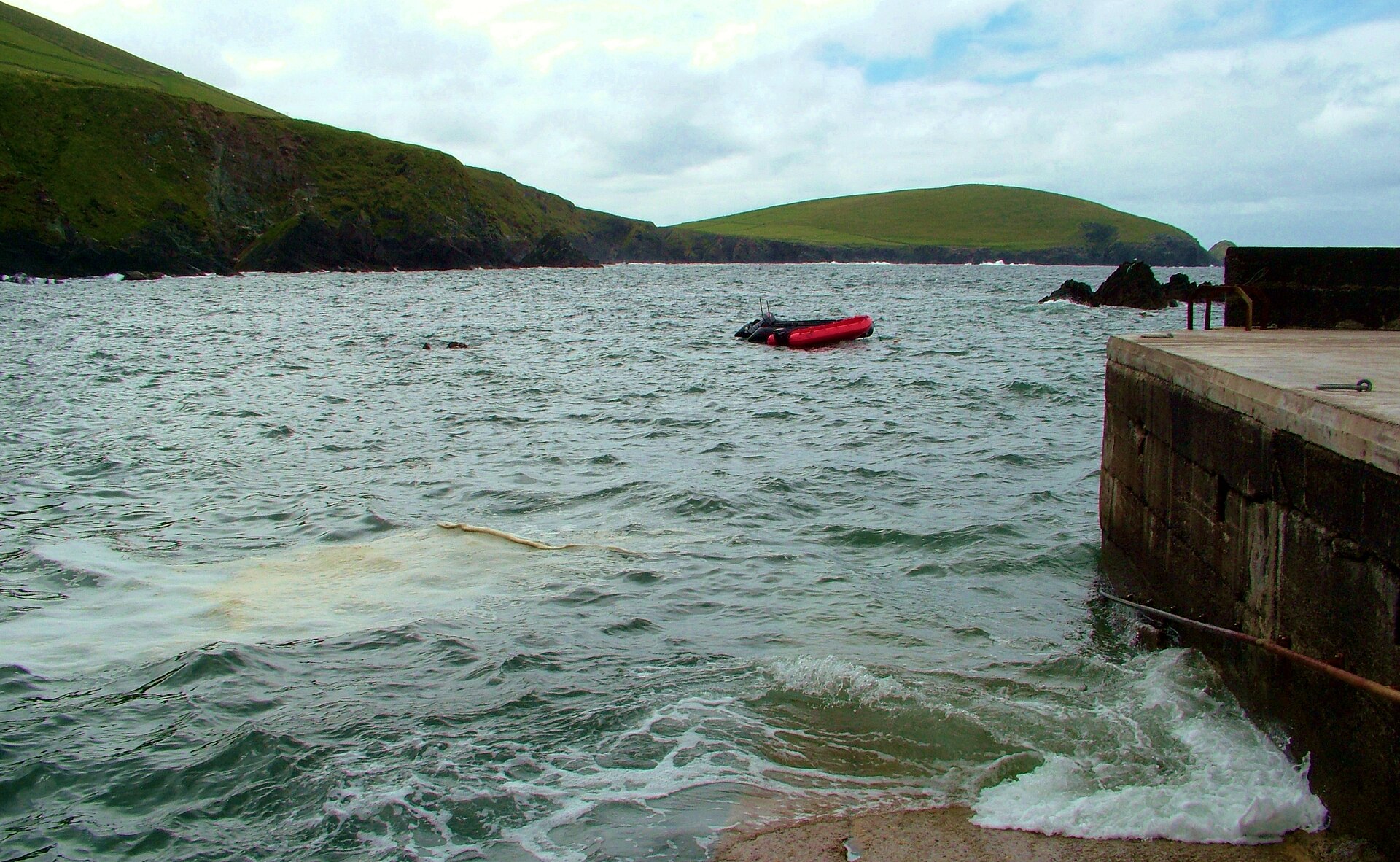
At the bottom, you arrive at a small stone harbour. The scale of the cliffs around you only becomes clear when you are standing at water level. It is a powerful feeling, and one that photographs only partially capture.
Getting to Dunquin Pier
Dunquin (Dún Chaoin) is a small village — or more accurately a scattering of farms and houses — on the western tip of the Dingle Peninsula. The nearest town is Dingle, which is approximately 20 kilometres to the east.
The pier is located on the R559, which is the main road for the Slea Head Drive. If you are coming from Dingle, follow signs for Slea Head Drive and continue west past Ventry and Slea Head. You will see signs for Dún Chaoin Pier as the road bends north.
Parking is available at the top of the pier — free, informal spaces on the clifftop rather than a paid car park. It fills up quickly between 10am and 2pm in July and August, so an early start is worthwhile.
By public transport, a TFI Local Link Kerry service (Route 277a) connecting Dingle and Dunquin runs year-round, but is infrequent. For most visitors, a hire car or a guided tour of the peninsula is the most practical option. The drive from Dingle takes around 30 to 40 minutes, depending on traffic and stops.
What to Expect When You Visit
The experience at Dunquin Pier divides into two distinct parts: the path down and the pier itself.
The path is the more photographed of the two. The zigzag steps are constructed from stone and concrete, with a painted railing along one side. Coastal wildflowers — yellow gorse in spring and early summer, sea pinks in late spring — grow along the cliff edges. The views out towards the Blasket Islands become broader with every step you take downwards.
At the bottom, you reach the pier itself: a compact stone harbour with a small shelter and information boards about the Blasket Islands and their history. In summer, the Blasket Island Ferry operates from here, running multiple crossings per day to the Great Blasket Island.
On rough days, the Atlantic swell makes the pier feel exposed and raw. On calm days, the water in the harbour is extraordinarily clear and takes on a deep greenish-blue colour. Both versions are worth seeing.
The pier area can get busy in July and August, particularly in the late morning when tour buses arrive. For a quieter experience, aim for before 9am or after 4pm.
The Blasket Islands: What You Can See and Do
Standing on the pier, the Blasket Islands stretch across the horizon. The largest, the Great Blasket Island (An Blascaod Mór), dominates the view. It was inhabited until 1953, when the last 22 remaining islanders were evacuated to the mainland at their own request and with government support — the community could no longer sustain itself through increasingly harsh conditions and dwindling population. Read more about the story of the last islanders to leave the Great Blasket Island.
The island’s story is told through several remarkable books written by islanders in the Irish language. Peig by Peig Sayers, The Islandman by Tomás Ó Criomhthain, and Twenty Years A-Growing by Muiris Ó Súilleabháin are three of the most celebrated. They give a vivid account of what daily life looked like on an isolated Atlantic island in the early twentieth century, and they remain in print today.
The Great Blasket Island is now managed by the National Parks and Wildlife Service of Ireland. Day trips run from Dunquin Pier between approximately April and September, subject to sea conditions. The crossing takes around twenty minutes. On the island, you can walk to the ruins of the old village, climb to the highest point for sweeping Atlantic views, and swim from the island’s beach in warmer months.
There are no permanent facilities on the island other than a small café that operates in summer. Bring food, water, and waterproof clothing regardless of the weather forecast — conditions can change quickly this far out on the Atlantic.
Planning a trip to the Dingle Peninsula? Our free newsletter covers the best drives, beaches, and hidden spots across Ireland every week. Sign up here — it is free and you can unsubscribe at any time.
The Slea Head Drive
Dunquin Pier is one stop on the Slea Head Drive, a circular route of approximately 47 kilometres that covers some of the most dramatic coastline on the Dingle Peninsula. The drive can be completed in two to three hours without stops, but most visitors take a full day to explore it properly.
Starting from Dingle town, the route heads west through Ventry and along the coast to Slea Head, where cliff-edge views across to the Blasket Islands are at their most dramatic. From Slea Head, the road continues north to Dunquin, then turns inland and east back through the village of Ballyferriter to Dingle.
Key stops along the way include:
- Ventry Beach — a long, sheltered sandy beach popular with families and suitable for swimming in summer
- Slea Head — the headland viewpoint with a car park, looking directly out to the Blaskets
- Coumeenoole Beach — a dramatic cove near Slea Head, one of Kerry’s most striking beaches
- Beehive Huts (Clochán) — ancient stone huts from the early Christian period, found on private farmland with a small admission charge
- Dunbeg Fort — an Iron Age promontory fort perched on the cliff edge, with visitor facilities
- Ballyferriter — a small village with a local heritage museum and café, in the heart of the Kerry Gaeltacht
The road is narrow in places. Take your time, drive slowly, and be prepared to pull in to allow oncoming vehicles to pass. Large motorhomes can find some sections challenging, particularly near Slea Head itself.
Practical Information for Visitors
Getting there: From Dingle town, take the R559 west towards Slea Head. Follow signs for Dún Chaoin / Dunquin Pier. The drive takes 30 to 40 minutes from Dingle.
Parking: Free off-road parking at the top of the pier steps (no official car park, no charge). It fills up by mid-morning in summer. Roadside overflow parking is available but do not block farm entrances.
Facilities: No toilets at the pier. The nearest public toilets are in Dingle town or at the Blasket Island Heritage Centre (Ionad an Bhlascaoid Mhóir), a short drive along the R559 in Dún Chaoin. The heritage centre also has a café and is well worth a visit for context on island life.
Best time to visit: May to September. July and August are the busiest months on the peninsula. May, June, and September offer comparable weather with noticeably quieter roads.
Weather: The Atlantic coast of Kerry is exposed and changeable. Pack a waterproof layer even in summer. Wind at the pier can be significant, particularly in the autumn and winter months.
Mobility: The path to the pier involves steep steps with a railing. It is not suitable for wheelchairs or prams. The view from the car park at the top of the steps is itself excellent and worth stopping for even if you cannot manage the descent.
Blasket Island Ferry: Operates seasonally, roughly April to September, subject to sea conditions. Book ahead in July and August as trips fill up. Check the ferry operator’s website or contact them directly before travelling, as sailings are weather-dependent.
What Else to See Nearby
If you are spending a few days on the Dingle Peninsula, there is plenty to fill your time beyond the Slea Head Drive.
Dingle town is the main hub, with a strong range of restaurants, pubs, and independent shops. The town has a lively food scene — seafood in particular — and the weekly farmer’s market draws local producers from across the peninsula.
Connor Pass is one of the highest mountain passes in Ireland open to road traffic. The views from the top stretch over both sides of the peninsula — north towards Brandon Bay and south towards Dingle Bay. On a clear day, it is one of the finest viewpoints in the country.
Inch Beach, on the southern side of the peninsula, is one of the longest beaches in Ireland, extending several kilometres into Dingle Bay. It is a popular surfing location and has café facilities at the car park.
Gallarus Oratory is a remarkably well-preserved early Christian stone church, whose exact date of construction remains uncertain — estimates range from the early medieval period into the 12th century. It was built using dry-stone corbelling, and has remained watertight for over a thousand years. It is one of the finest examples of early Irish Christian architecture in the country.
Dunquin Pier does not announce itself with signage or spectacle. What it offers is straightforward: a dramatic cliff path, a working harbour at the edge of the Atlantic, and an unobstructed view of islands that tell one of Ireland’s most remarkable human stories. That is more than enough.
If you are planning to visit the Dingle Peninsula — or anywhere else in Ireland — our free weekly newsletter has the practical guides and local insights to help you make the most of every trip. Subscribe to Love Ireland and never miss a destination.
Thinking about it seriously?
If you’ve started actually planning a move, our complete the full Move to Ireland guide walks through every step, every cost, and the paperwork that catches most people out.
Tours & experiences you might love


Powered by Viator. Some links are affiliate links — we may earn a small commission at no extra cost to you.
Secure Your Dream Irish Experience Before It’s Gone!
Planning a trip to Ireland? Don’t let sold-out tours or packed attractions spoil your journey. Iconic experiences like visiting the Cliffs of Moher, exploring the Rock of Cashel, or enjoying a guided walk through Ireland’s ancient past often sell out quickly—especially during peak travel seasons.

Booking in advance guarantees your place and ensures you can fully immerse yourself in the rich culture and breathtaking scenery without stress or disappointment. You’ll also free up time to explore Ireland’s hidden gems and savour those authentic moments that make your trip truly special.
Make the most of your journey—start planning today and secure those must-do experiences before they’re gone!