

Ireland’s coastline runs for over 2,500 kilometres, much of it facing directly into the North Atlantic. Every winter, that exposure matters. January storms sweep in from the west and north-west with remarkable regularity, and when they arrive, some counties feel them far more than others.
The question of which county takes the worst battering sparks genuine debate — especially among people who grew up near the coast. So let’s look at what the geography, history and weather records actually tell us.
Love Ireland? Get our weekly newsletter — stories, history and hidden corners of the island, delivered straight to your inbox. Subscribe free here.
What Makes a Coastal County Storm-Prone?
Not all coastlines face the same risks. Ireland’s storm exposure depends on several factors: the direction the coastline faces, how much natural shelter exists from headlands or offshore islands, the depth of the water offshore, and how high the land sits above sea level.
Atlantic storms track from west to north-west for the most part. Counties facing this direction with few natural barriers — no islands, no mountain ridges to break the wind — receive the full force. Sheltered bays and inlets can reduce wave height but do little to stop gusts reaching inland areas.
The prevailing direction of Atlantic low-pressure systems means that the western and north-western counties are in the firing line almost every year from November through March. January is typically the worst month of all.
Donegal – The North-West Frontline
Donegal has a strong claim to being Ireland’s most storm-battered county. Malin Head, Ireland’s most northerly point, sits in County Donegal and has recorded some of the country’s highest sustained wind speeds. The county’s coastline stretches for more than 1,134 kilometres — among the longest of any Irish county — meaning it presents a vast surface area to incoming Atlantic systems.
The Inishowen Peninsula, Horn Head, Bloody Foreland and the Fanad Peninsula are all fully exposed to north-westerly gales. When red weather warnings are issued for Ireland, Donegal is almost always first on the list.
In January 2025, Storm Éowyn struck Ireland with historic force. The strongest gust recorded on land during that storm came from Connacht, but Donegal recorded sustained winds that made it one of the most severe storms in the county’s recorded history. Trees, power lines and roads were all affected across north Donegal for several days.
Donegal also lacks the shelter of islands along much of its northern coast. The county faces into the North Atlantic with relatively little to blunt the approach of deep low-pressure systems tracking in from Iceland and the Labrador Sea.
Mayo – Achill Island and the Erris Coast
Mayo makes a powerful case for second place, and some would argue first. Achill Island, connected to the mainland by a bridge, is Ireland’s largest island and sits fully exposed to Atlantic swells on its western and northern shores. Keem Bay on Achill’s western tip and Achill Head give a clear picture of the raw exposure this county faces in winter.
The Erris peninsula in north-west Mayo is one of the most remote stretches of coastline in Ireland. Storm waves regularly overtop roads in Belmullet, the town at the base of the peninsula. Met Éireann’s monitoring station at Belmullet has recorded hurricane-force gusts during several winter storms in recent years.
Mayo’s coastline is also notable for its length and complexity — more than 1,168 kilometres when islands and inlets are included. This large coastal footprint means that somewhere in Mayo is almost always being hit hard during major Atlantic events.
Love Ireland? Get our weekly newsletter — stories, history and hidden corners of the island, delivered straight to your inbox. Subscribe free here.
Clare – Where the Cliffs Take the Full Force
County Clare does not have the longest coastline, but the Cliffs of Moher and Loop Head face due west into the open Atlantic. When storm swells build across thousands of kilometres of open ocean, they arrive at Clare’s western edge with enormous energy behind them.
The Cliffs of Moher, rising to 214 metres at their highest point, absorb that wave energy directly during January storms. Spray from breaking waves has been observed reaching heights of 60 metres or more during major events. Loop Head lighthouse has recorded hurricane-force gusts during severe winters, and the road to Loop Head can be impassable after significant Atlantic swells.
The difference with Clare is that much of the storm impact is absorbed by those cliffs and headlands before it reaches towns and farmland. Kilkee, Kilrush and Ennistymon can still flood during major events, but Clare’s exposed coast takes more of the energy than its inhabited hinterland.
Kerry – Headlands, Islands and History
Kerry’s geography is complicated. The county has deep sheltered bays — Dingle Bay, Kenmare Bay, the Kenmare River estuary — which reduce storm impact significantly in those inlets. But the exposed headlands tell a very different story.
Brandon Point on the Dingle Peninsula faces north-west and receives the full force of winter storms. Valentia Island, home to one of Ireland’s oldest weather observation stations, has measured some of the country’s most extreme winter conditions since the 1860s.
The Great Blasket Island, abandoned in 1953, was partly vacated because the community there could not survive the isolation that winter storms imposed for weeks or months at a time. The difficulty of maintaining a safe boat crossing between the island and the mainland was a key factor in the decision to leave. The island sits three kilometres off the tip of the Dingle Peninsula, fully exposed to the south-west Atlantic.
Kerry’s storm exposure is more variable than Donegal or Mayo, but at the exposed headlands and offshore islands, it rivals anywhere in Ireland.
Galway – Town Flooding and the Aran Islands
Galway receives a different kind of storm impact. Galway city sits in Galway Bay, partially sheltered by the Aran Islands and the Burren coast of County Clare. However, when storm surges combine with high tides, Salthill and the city centre can flood significantly, causing major disruption.
The Aran Islands themselves — Inis Mór, Inis Meáin and Inis Oírr — sit directly in the path of Atlantic swells. Ferry crossings from Rossaveel or Doolin are cancelled regularly in winter, sometimes for days at a stretch. The dense network of stone walls covering Inis Mór is a practical response to centuries of wind exposure — hedges and trees simply cannot survive there.
The Connemara coast, running north of Galway Bay, also takes serious storm damage. The area around Roundstone and Clifden receives large Atlantic swells and frequent gale warnings between November and February each year.
Antrim – The North’s Exposed Shore
County Antrim’s north coast faces the North Channel and the open waters towards Scotland. While it benefits from some shelter compared to the pure Atlantic exposure of Donegal and Mayo, the north Antrim coast is no stranger to severe winter storms.
Rathlin Island, off Ballycastle, is regularly cut off in winter when rough seas make the crossing unsafe. Fair Head and the Giant’s Causeway area receive considerable storm impact during north-westerly gales, and the basalt columns of the Causeway were, of course, shaped by geological forces that make today’s Atlantic storms look mild.
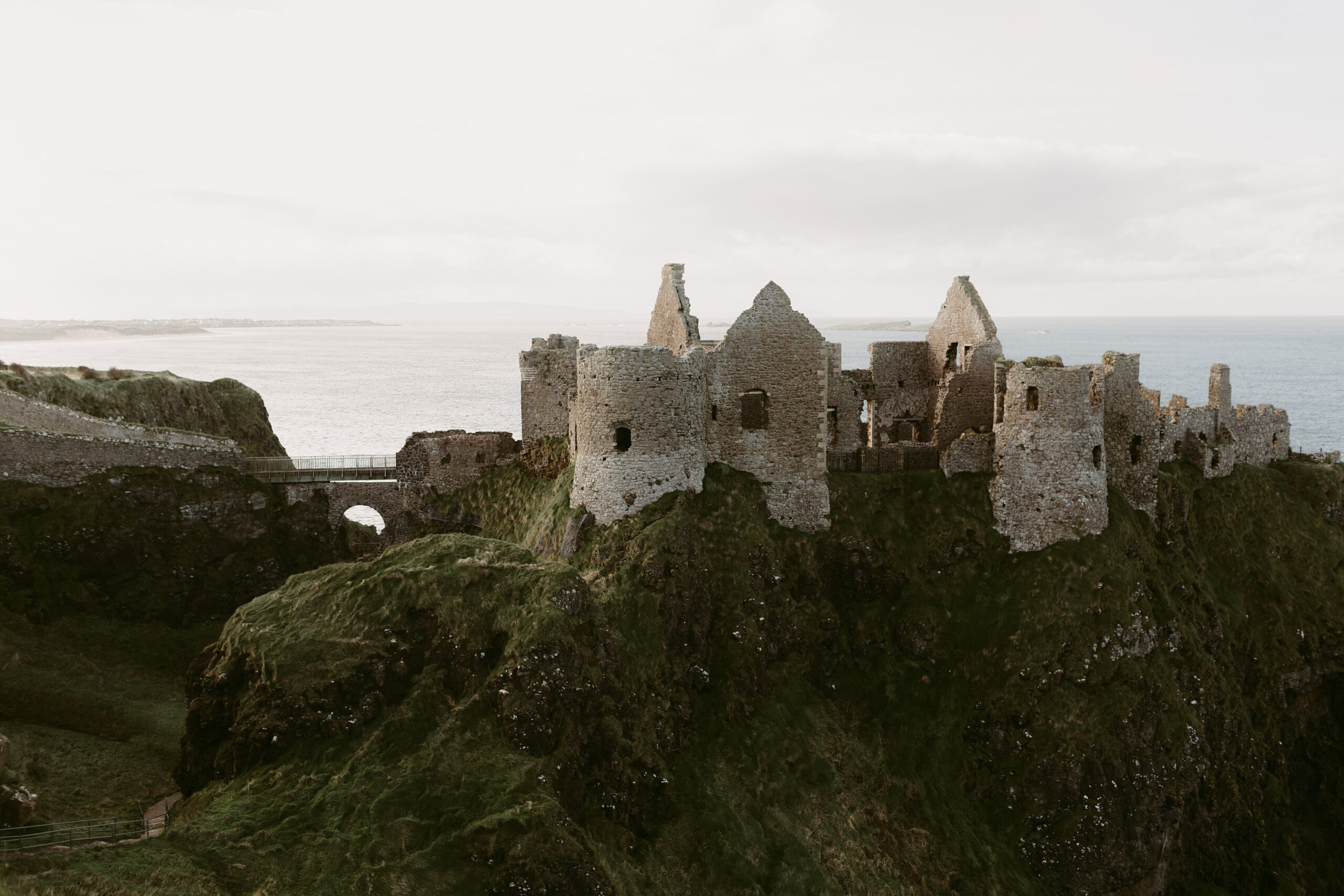
Dunluce Castle, which stands on the cliff edge between Portrush and Bushmills, is one of the most dramatic reminders of what coastal storms can do over centuries. In 1639, part of the castle’s kitchen fell into the sea during a storm — an event so remarkable it was recorded in historical documents. The castle’s ruined state today owes something to centuries of exposure to north Atlantic weather.
What the Weather Records Show
Met Éireann publishes data on storm frequency and severity by location. Consistently, the north-west and west of Ireland — Donegal, Mayo, Galway and Clare — record the highest frequency of storm-force winds in January.
The Night of the Big Wind, 6–7 January 1839 — known in Irish as Oíche na Gaoithe Móire — remains the most destructive storm in Irish history, with contemporary accounts describing gusts estimated around 185 km/h, though no instrumented weather network existed at the time to produce an official reading. It killed hundreds of people, destroyed thousands of homes, and uprooted millions of trees across the western seaboard.
Storm Éowyn in January 2025 set the new record for Ireland’s highest instrumented wind gust, at 184 km/h at Mace Head, County Galway — surpassing the previous instrumented record of 182 km/h set at Foynes, County Limerick, in 1945. Ireland’s two storm superlatives — the most destructive on record and the windiest ever measured — both trace back to the west coast, which tells you something about where the worst conditions tend to gather.
The Verdict — and Why It Matters
Donegal edges ahead on most measures. It has one of the longest coastlines of any Irish county, the most north-westerly position, the most frequent storm-force wind recordings, and the fewest natural barriers between its land and the open ocean. Mayo is a close second, with Achill Island and the Erris Coast providing some of the most exposed terrain in Europe.
Clare and Kerry are strong contenders when you factor in wave height and cliff exposure. Galway and Antrim complete what you might call the front row of Ireland’s storm-battered counties.
What is clear is that Ireland’s entire western and northern coast is shaped — by centuries of geology and relentless weather — to absorb serious punishment every January. The people who live along that coast know the storms by name, track them on their phones, and check tide times before deciding whether to drive a coastal road. That knowledge is part of what makes coastal Ireland so distinct from anywhere else.
The debate about which county gets it worst will run as long as the storms do — which, on the evidence, is for a very long time yet.
Love Ireland? Get our weekly newsletter — stories, history and hidden corners of the island, delivered straight to your inbox. Subscribe free here.
☘️ Join 64,000+ Ireland Lovers
Every weekday morning, get Ireland’s hidden gems, local secrets, and travel inspiration — the kind you won’t find in any guidebook.
Subscribe free — enter your email:
📲 Know someone who’d love this? Share on WhatsApp →
Love more? Join 43,000 Scotland lovers → · Join 29,000 Italy lovers → · Join 7,000 France lovers →
Free forever · Unsubscribe anytime
Ireland’s coastal counties — Donegal, Mayo, Clare, Kerry — are also the counties that sent the most emigrants abroad during the 18th and 19th centuries. The same Atlantic that shapes these coastlines carried emigrant ships to America and beyond. If your family has roots in any of Ireland’s coastal counties, our free Irish Ancestral Heritage Guide includes county-specific emigration records, passenger lists, and townland maps. Find your coastal Irish ancestors here — free.
Tours & experiences you might love


Powered by Viator. Some links are affiliate links — we may earn a small commission at no extra cost to you.
Secure Your Dream Irish Experience Before It’s Gone!
Planning a trip to Ireland? Don’t let sold-out tours or packed attractions spoil your journey. Iconic experiences like visiting the Cliffs of Moher, exploring the Rock of Cashel, or enjoying a guided walk through Ireland’s ancient past often sell out quickly—especially during peak travel seasons.

Booking in advance guarantees your place and ensures you can fully immerse yourself in the rich culture and breathtaking scenery without stress or disappointment. You’ll also free up time to explore Ireland’s hidden gems and savour those authentic moments that make your trip truly special.
Make the most of your journey—start planning today and secure those must-do experiences before they’re gone!